Photo courtesy of the "Hunot Gorge" State Nature and Historical Reserve
Hunot Bridge
Monument
Monument type
Bridge Given name
Hunot Bridge initial, sequential and current
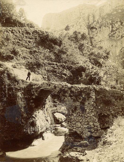
Built in the 18th century, used until September 2020.
The name of conservation unit
Bridge
A topographic report
Region (province), community
The area of Hunot is located in the border region of the Harchlank and Myus Haband provinces in historical Artsakh within Greater Armenia. It later became part of the Varanda district and the corresponding principality. Since the 19th century, it has been included in the Shushi district of the Elisabethpol Governorate. The village of Hunot was depopulated in the 1930s.
Address
Republic of Artsakh, Shushi District, Hunot Settlement
Topography
Located approximately 500 meters east of the Shushi fortress.
Site elevation above sea level
It is 969 m above sea level. Hydrography
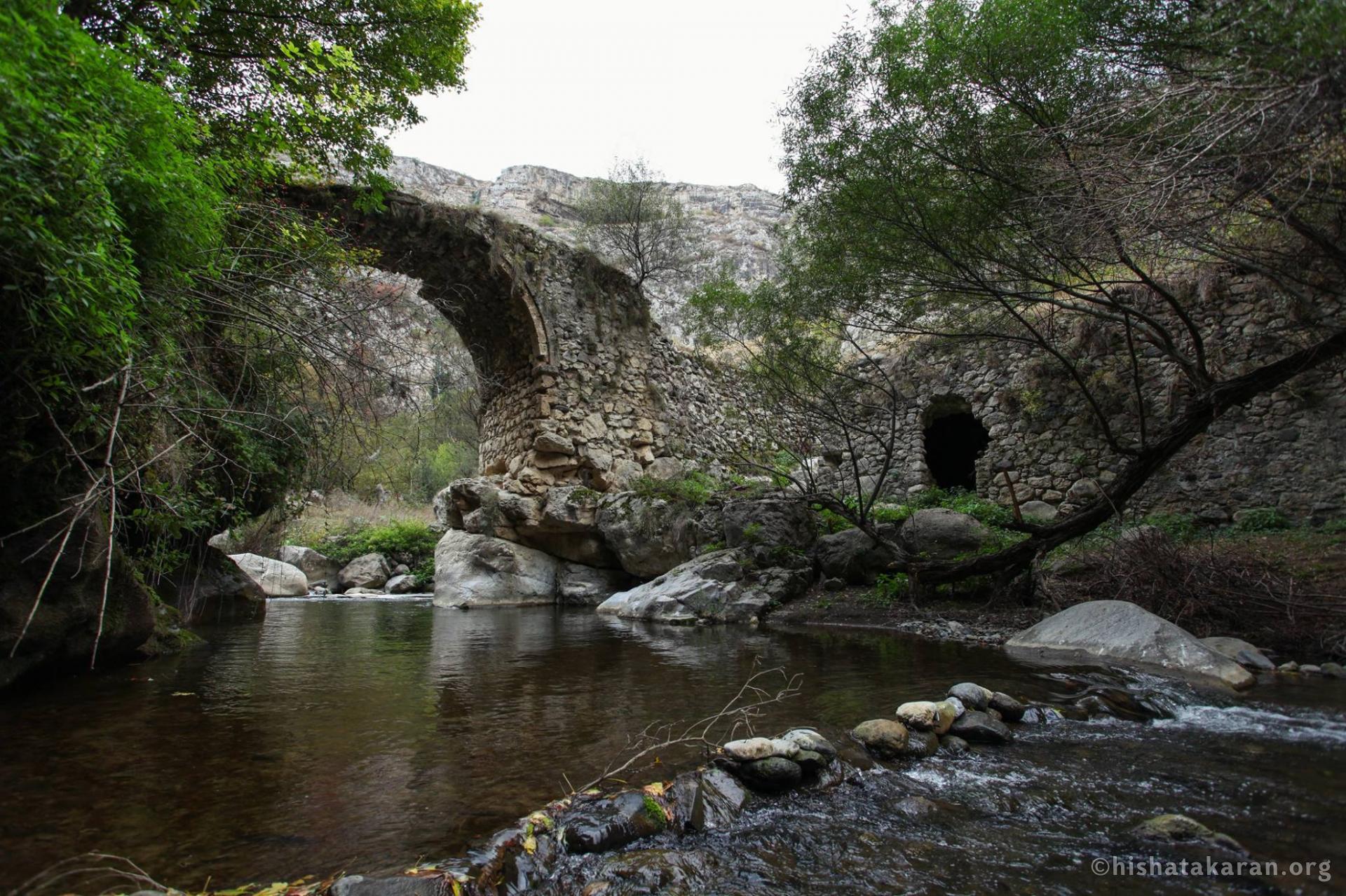
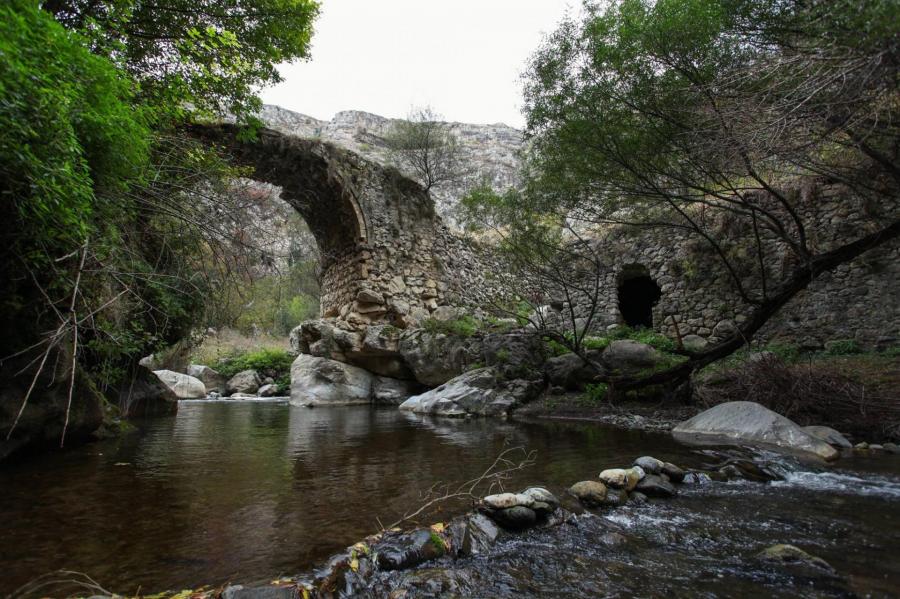
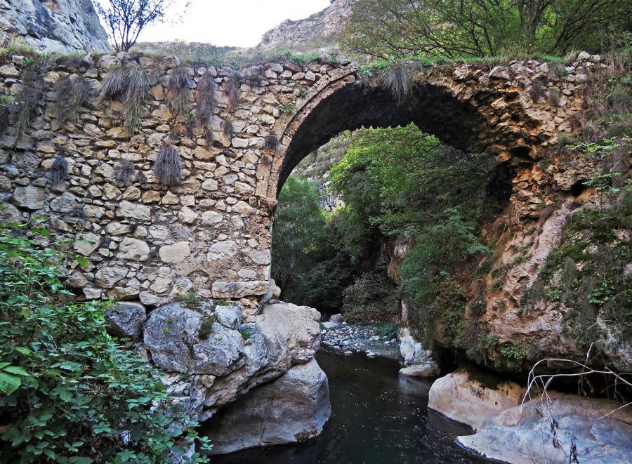
Located over the Karkar River. Description
Hunot village is located in the Shushi region of the Republic of Artsakh, on the eastern edge of the Hunot village site, spanning the Karkar River. The bridge was initially designed and constructed for pedestrians and carts. It was one of the key junctions connecting Shushi to Avetaranots, the center of the Varanda Principality, further south to Togh, the princely seat of Dizak, as well as to the town of Hadrut.
It is a single-span, arched stone bridge with abutments resting on natural rock formations. The passageway measures nearly 20 meters in length and 4 meters in width. The span"s length is 5.87 meters. The abutments" foundation walls are positioned high above the river, supported by naturally protected massive rock formations. The rock mass on the left bank is positioned higher, causing the bridge"s arched span to nearly merge with the rock on that side. The bridge is built from limestone, river stones, and lime mortar, with only the cornerstones of the arches made from dressed stones.
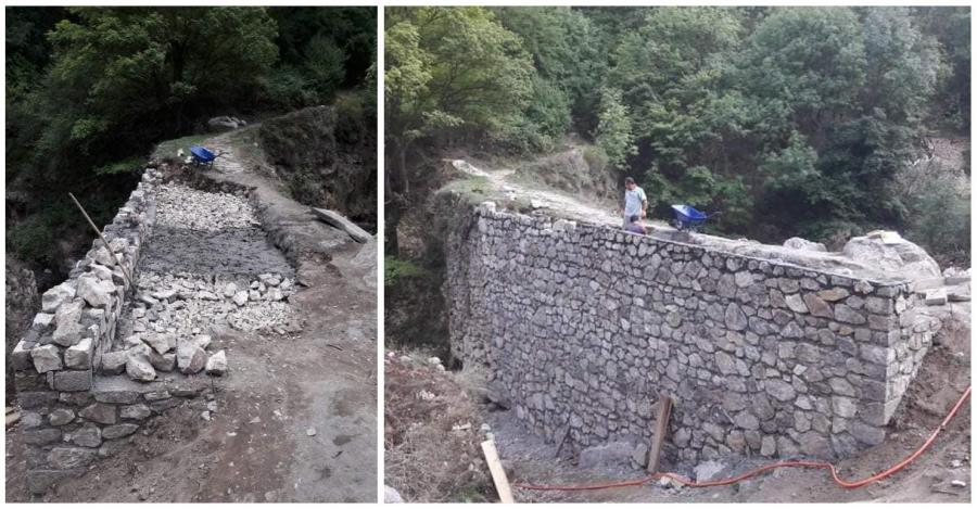
In 2019-20, the bridge was undergoing renovation. However, the work remained unfinished due to the Azerbaijani aggression that began on September 27, 2020.
Historical record
Cultural characteristics, period, century (centuries)
Varanda Principality, 18th century
Documents for dating: according to the iconography
According to architectural and construction features Chronological table of monument
Built in the 18th century, it served its purpose until 2020. The area was subsequently occupied by Azerbaijan. Information about the current condition of the monument is not available.
Chronological table of research on the monument (period, author, works)
The monument was studied and surveyed by Samvel Karapetyan.
Descriptive-Characterization Report
Architectural overview: architectural composition
Arched, single-span
Building material (type, colour)
Limestone, lime mortar
Finishing and decoration
Restrained
Dimensions: length
20.1 meters (the length of the passageway) Dimensions: width
4.05 meters (the width of the passageway) Dimensions: height
It is 8.10 meters above the river. Length of span
The span length, 5,87meters The condition of the monument before the forced displacement of Armenians
Average
Value
The bridge held significant economic and strategic importance during the 18th and 19th centuries. It was one of the key junctions connecting Shushi to the center of the Varanda Principality, Avetaranots, and further south to Dizak. ----------------------------
1Karapetian S․, Arc’axi kamurjnerě [The bridges of Artsakh], Yerevan, 2009, p. 92.Measurements

The bridge of Hunot
Measurement: Samvel Karapetyan (RAA)
Photos
...
Main bibliography
.
A. H., S. D.