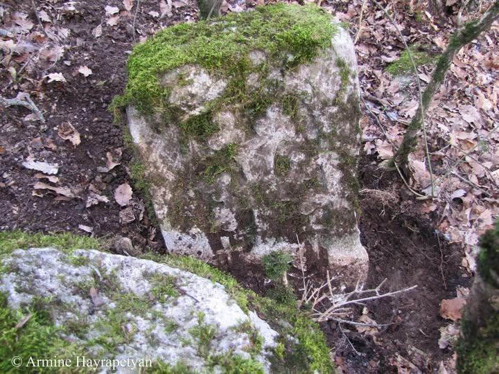
Karaglukh [Kʻaraglukh] hamlet, Kuchir shal cemetery, khachkʻar (cross-stone) № 11
Monument
.
Registrated monument
Monument type
Khachkar Given name
It doesn"t have initial, sequential and current
Burial monument
Original ownership and affiliation
K‘araglukh village
The name of conservation unit
Khatchkar
A topographic report
Region (province), community
The province of Great Aṛank (later Khatchen, Khach‘en), from the Artsakh region of Greater Historical Armenia. Until 2020, Republic of Artsakh, Askeran region, Khramort‘ village, K‘araglukh hamlet. The village was occupied by the Azerbaijani army in 2022, on March 24, thus the fate of the monument is unknown.
Address
Khramort‘ village, K‘araglukh hamlet
Topography
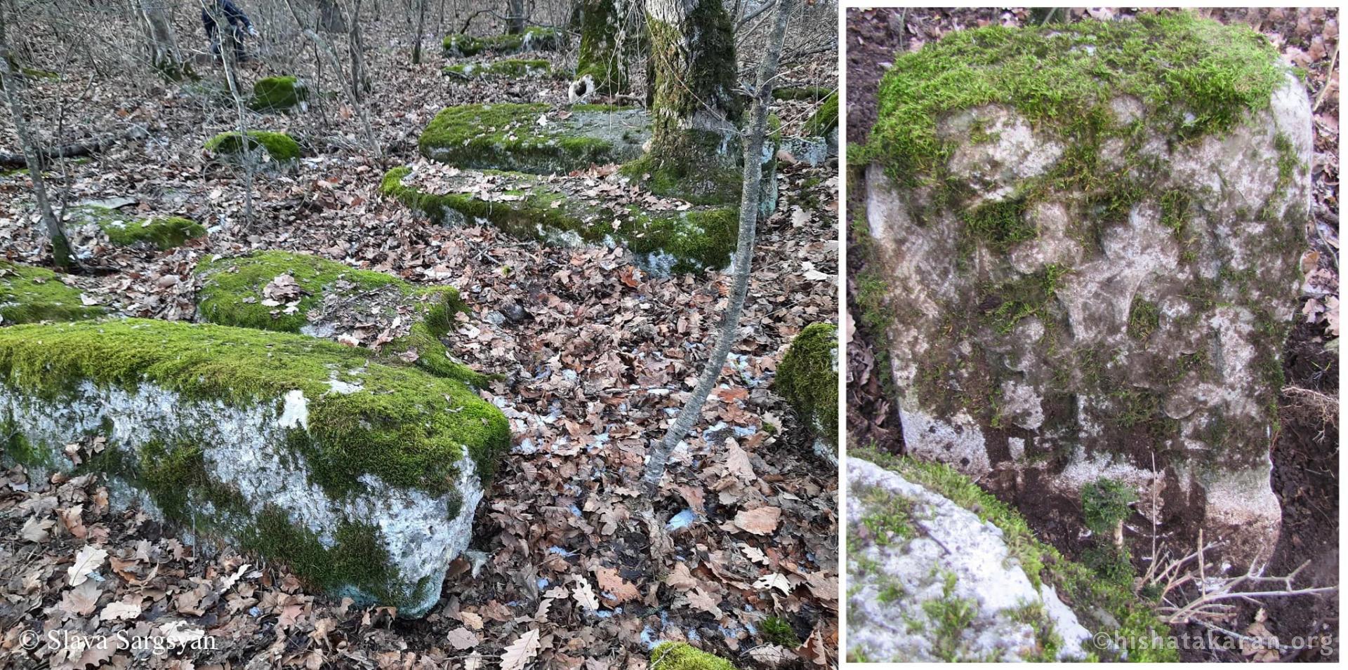
It is located 6.5 km northwest of Askeran, in the Kuchir shal area of K‘araglukh village.
Distance and location from community
About 0.5 km southeast of the village of K‘araglukh, in the recently discovered cemetery.
Site elevation above sea level
It is located at an altitude of 1012 meters. Hydrography
It is located 4.10 km south of Khach‘enaget, on the eastern wooded slope of Mount Shikak‘ar. Historical record
Cultural characteristics, period, century (centuries)
Armenian Apostolic Church, Middle Ages, 13th-14th centuries.
Documents for dating: according to the iconography
According to the stylistic and artistic characteristics Brief historical overview
A newly discovered khachkar is being published for the first time. There is no information or data about the monument in historical sources.
Descriptive-Characterization Report
Building material (type, colour)
White-gray limestone
Dimensions: width
52 sm Dimensions: height
80 sm Dimensions: depth, thickness
30 sm Value
This khatchkar and dozens of burial monuments in the same location have been recently discovered and hold significant historical and cultural importance not only in terms of studying the village of K‘araglukh and Artsakh, but also medieval Armenian burial monuments.
Photos